- Start
- GIS for Science, Volume 3
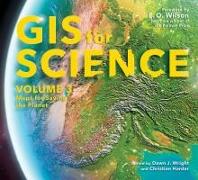
GIS for Science, Volume 3
Angebote / Angebote:
At a time when so much in the natural world is on the line, GIS-driven mapping leads us to make more science-informed decisions about the myriad forces affecting life on Earth. This third volume of GIS for Science focuses on biodiversity. The new collection presents real-world examples of scientists creating the maps that are saving the planet, documenting and helping protect biodiversity. The book’s contributors use GIS to fuse data gathered through the collective lenses of global satellite observation, forestry, marine policy, artificial intelligence, conservation biology, and environmental education. This volume introduces several global action initiatives such as Half-Earth, 30 x 30, AI for Earth, the Blue Nature Alliance, and the Sustainable Development Solutions Network.
The stories in GIS for Science: Maps for Saving the Planet are written for the professional scientist and conservationist and anyone interested in learning about the intersection of technology and the conservation of nature. The book’s contributors represent a cross section of scientists applying geographic data gathered from the full spectrum of remote sensing and on-site technologies to help save the planet. This data is brought to life using ArcGIS software, the ArcGIS Online cloud-based system, and other spatial data science tools to support research, collaboration, spatial analysis, and science communication across many settings and communities. These stories, along with the book’s companion website, present GIS ideas and inspiration applied across many disciplines that can aid in the effort to save planet Earth while there’s still time.
Lieferbar in ca. 10-20 Arbeitstagen
Preis
52,50 CHFVerfügbarkeit:
LieferbarArtikel, die Sie kürzlich angesehen haben

Lieferbar in ca. 5-10 Arbeitstagen