- Start
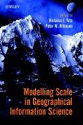
- Modelling Scale in Geographical Information Science
Modelling Scale in Geographical Information Science
Angebote / Angebote:
Scale has long been a fundamental concept in geography. Its importance is emphasised in geographical information science (GIScience) where the computational domain necessitates the rigorous definition and handling of scale. Geographical information systems are now used in almost every walk of life, but scale is often handled poorly in such systems. "Modelling Scale in Geographical Information Science "is written by an international team of contributors drawn from both industry and academia, and considers models and methods of scaling spatial data in both human and physical systems. This book is split into three sections to give a balanced coverage of the key problems, tools and models associated with scale. Part 1 considers the fractal model of spatial variation. Fractals are mathematical models of spatial variation which are independent of scale. Part 2 addresses the modifiable areal unit problem (MAUP), which continues to be the scale issue for census data. The MAUP is comprised of two component problems: a scaling problem and a zonation problem and is intrinsic to the spatial analysis of census-type data in which the areal units vary from place to place in size, shape and orientation. The concepts of changing scale and regularization are covered in Part 3. The emphasis here is upon the tools of geostatistics (for continuous field data) and generalization (for vector models) which are used to change the scale of measurement. This book is an essential read for all GIScience researchers, advanced students and practitioners who want to delve more deeply into the scale issues of the spatial data and spatial models that form the basis of their analyses.
Folgt in ca. 15 Arbeitstagen

