- Start
- Map Point Reyes National Seashore: And West Marin Parklands
Map Point Reyes National Seashore: And West Marin Parklands
Angebote / Angebote:
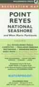
Find your way around Point Reyes National Seashore and vicinity with this topographic map showing every major road, trailhead, and trail in the park. This 4-color map shows all established campgrounds, picnic and parking areas, restrooms, telephones, and visitor centers. Also covers Samuel P. Taylor State Park, Audubon Canyon Ranch, Tomales Bay State Park, Bolinas Lagoon Open Space Preserve, and parts of the Golden Gate National Recreation Area, plus an inset of the Bear Valley Visitor Center area. Includes 30 miles of the Bay Area Ridge Trail from Bolinas Ridge to Big Rock Ridge. This 4-color topographic map is printed on waterproof, tear-resistant plastic.
Fremdlagertitel. Lieferzeit unbestimmt