- Start
- Rand McNally: Columbus/Cincinnati, Ohio Regional Map
Rand McNally: Columbus/Cincinnati, Ohio Regional Map
Angebote / Angebote:
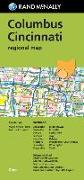
Rand McNally's folded map for Columbus Cincinnati is a must-have for anyone traveling in and around this part of Ohio, offering unbeatable accuracy and reliability at a great price. Our trusted cartography shows all Interstate, U.S., state, and county highways, along with clearly indicated parks, points of interest, airports, county boundaries, and streets. The easy-to-use legend and detailed index make for quick and easy location of destinations. You'll see why Rand McNally folded maps have been the trusted standard for years. Regularly updated Full-color maps Clearly labeled Interstate, U.S., state, and county highways Indications of parks, points of interest, airports, county boundaries, downtown & vicinity maps Major attractions & Golf Courses Enlargements of Cincinnati downtown, Columbus downtown, Dayton downtown, Port Columbus Int'l Airport, Cincinnati-Northern Ky. Int'l Airport Easy-to-use legend Detailed index & Major Street Index Convenient folded size Copyright 2019 Coverage Area Chillicothe, Circleville, Dayton, Fairfield, Hamilton, Hillsboro, Lancaster, Marysville, Middletown, Rossville, Springfield, Troy, Urbana, Washington Court House, Wilmington, Xenia Product Details Measures 9.5" x 4" and folds out to 40" x 28
Folgt in ca. 15 Arbeitstagen