- Start
- Rand McNally Folded Map: Baltimore Street Map
Rand McNally Folded Map: Baltimore Street Map
Angebote / Angebote:
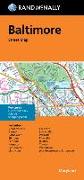
Rand McNally's folded map for Baltimore is a must-have for anyone traveling in and around this part of Maryland, offering unbeatable accuracy and reliability at a great price. Our trusted cartography shows all Interstate, U.S., state, and county highways, along with clearly indicated parks, points of interest, airports, county boundaries, and streets. The easy-to-use legend and detailed index make for quick and easy location of destinations. You'll see why Rand McNally folded maps have been the trusted standard for years. - Regularly updated. - Full-color maps. - Clearly labeled Interstate, U.S., state, and county highways. - Indications of parks, points of interest, airports, county boundaries, schools, shopping malls, and vicinity maps. - Enlargements of downtown. - Easy-to-use legend. - Detailed & full street index. - Convenient folded size. Coverage Area Communities Included: Brooklyn Park, Carney, Catonsville, Elkridge, Ferndale, Hampton, Lansdowne, Linthicum, Lochearn, Lutherville, Parkville, Pikesville, Ruxton, Towson, Woodlawn. Product Details: Measures 9.5' x 4' and folds out to 40' x 28'.
Folgt in ca. 15 Arbeitstagen