- Start
- Rand McNally Folded Map: Greensboro, High Point Street Map
Rand McNally Folded Map: Greensboro, High Point Street Map
Angebote / Angebote:
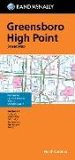
Rand McNally's folded map featuring the streets of Greensboro, and High Point is a must-have for anyone traveling in and around this part of North Carolina, offering unbeatable accuracy and reliability at a great price. Our trusted cartography shows all Interstate, U.S., state, and county highways, along with clearly indicated parks, points of interest, airports, county boundaries, and streets. You will see why Rand McNally folded maps have been the trusted standard for years. - Regularly updated, full-color maps. - Clearly labeled Interstate, U.S., state, and county highways. - One-way streets indicated. - Indications of county boundaries, schools, shopping malls, parks, golf courses, hospitals, airports, and points of interest. - Easy-to-use legend. - Detailed street index. - Compact folded size. Coverage Area Communities include: Archdale, Jamestown, Oak Ridge, Summerfield, Thomasville, and Trinity. Product Details: Measures 9.5 x 4 and folds out to 40 x 28.
Folgt in ca. 15 Arbeitstagen
Preis
14,50 CHFVerfügbarkeit:
LieferbarArtikel, die Sie kürzlich angesehen haben


Folgt in ca. 15 Arbeitstagen