- Start
- Remote Sensing and GIS for Sustainable Forest Management
Remote Sensing and GIS for Sustainable Forest Management
Angebote / Angebote:
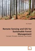
Forests are the most widely distributed ecosystem on the earth, affecting the lives of most humans daily, either as an economic good or an environmental regulator. To study Forest areas effectively and to monitor changes over time, accurate, rapid, and cost-effective monitoring techniques are required. Satellite data potentially provide a useful tool for estimating forest cover and monitoring changes very rapidly over large areas and with a minimum of ground data collection. Remote sensing has been a valuable source of information over the course of the past few decades in monitoring forest activities. This book is designed to meet the needs of a professional audience composed of both practitioners and researchers and has been written covering various aspects of Remote Sensing techniques for Sustainable Forest Management. This book is also suitable as a reference text for post-graduate/ graduate-level teachers and students in Forestry, Environmental Science, Geography and Remote Sensing. Since this book contains detailed methodologies to study varies aspects of Forest, it creates a vivid and essential reference text for all those interested in Forestry and Environmental Science.
Folgt in ca. 5 Arbeitstagen


