- Start
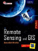
- Remote Sensing and GIS
Remote Sensing and GIS
Angebote / Angebote:
Remote Sensing is designed to meet the requirements of undergraduate courses in civil engineering, geoinformatics/geomatics engineering, geotechnical engineering, survey engineering, and environmental engineering. It provides a thorough understanding of remote sensing and GIS technology.
Lieferbar in ca. 10-20 Arbeitstagen


